
A-Frame, a web framework for building virtual reality experiences.
This repository is an introduction to common tasks for organising WebAR projects. Examples are hosted on GitHub Pages for convenient reference.
Defocusing the camera background can degrade performance – consider this if you need to quickly pick out the subject in 3D.
blur.html applies CSS filters to #arjs-video canvas:
#arjs-video {
    filter: blur(8px);
    -webkit-filter:blur(8px);
    /* transform: scale(1.8); *//* Might stretch CPU! */
  }
trex.html extends aframe.min.js with aframe-ar.js, a marker + location based build without NFT support.
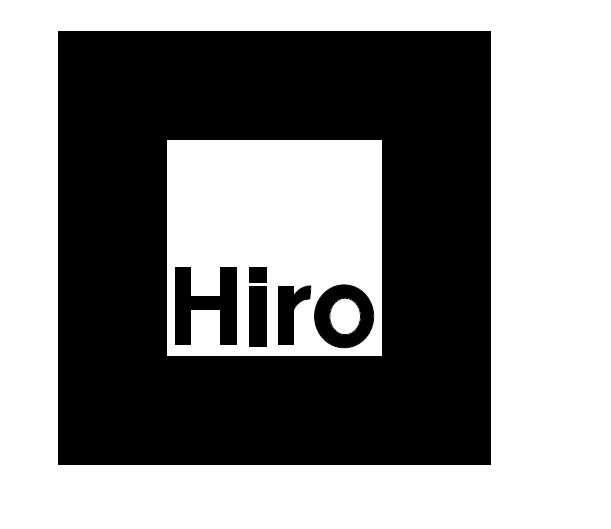
Print the marker or use it on your tablet todisplay a glTF model on-top of this marker (8Kb jpg, or 1Kb webP). Open trex.html on your mobile and point the camera to:

In the HTML, you'll notice rotation="pitch yaw roll" to describe each degree of freedom. This makes orientation of 3D objects in co-ordinate space trivial:
Roll, Pitch, Yaw:
 - pitch: vertical rollercoaster up/down, nose & tail (nose dive: 90°).
 - yaw: steering, like a bike (opposite direction: -90°).
 - roll: horizontal tilting, like plane wings (try: 45°).
See: shadow-material.html working in the viewport.
getOrCreateObject3D('name', constructor) applies shadow-material attribute directly to <a-plane>. This script works in the <head>:
AFRAME.registerComponent('shadow-material', {
      init() {
        this.material = new THREE.ShadowMaterial();
        this.el.getOrCreateObject3D('mesh').material = this.material;
        this.material.opacity = 0.3;
      }
    });
In the console the entity a-scene in markerless.html shows device location AR:
<!doctype html>
<html>

<head>
  <link rel="canonical" href="https://inspiredlabs.github.io/ar.js/markerless.html" />
  <!-- location based aframe v0.9.2 -->
  <script src="https://aframe.io/releases/0.9.2/aframe.min.js"></script>
  <script src="https://raw.githack.com/AR-js-org/AR.js/master/aframe/build/aframe-ar-nft.js"></script><!-- debug -->
  <script>
    const log = console.log;
    window.onload = () => {
      let scene = document.querySelector('a-scene'); /* Apply to whole scene */

      if (navigator.geolocation) {
        navigator.geolocation.getCurrentPosition(function (position) {
          let gps = document.createAttribute('gps-entity-place'),
            arjs = document.createAttribute('arjs'),
            welcome = document.getElementById('welcome');

          arjs.value = 'sourceType: webcam; sourceWidth: 1280; sourceHeight: 960; trackingMethod: best; debugUIEnabled: false;';
          gps.value = `latitude: ${position.coords.latitude - 0.001}; longitude: ${position.coords.longitude + 0.001}`;
          log(gps.value);
          scene.setAttributeNode(gps); /* Apply to whole scene */
          scene.setAttributeNode(arjs);
        });
      }

    };
  </script>
</head>
<a-scene vr-mode-ui="enabled: false">
  <a-entity id="wrapper" position="0 -8 0">

    <a-box position="-1 0.5 -3" rotation="0 45 0" color="#4CC3D9" shadow></a-box>
    <a-sphere position="0 1.25 -5" radius="1.25" color="#EF2D5E" shadow></a-sphere>
    <a-cylinder position="1 0.75 -3" radius="0.5" height="1.5" color="#FFC65D" shadow></a-cylinder>
    <a-plane position="0 0 -5.0" rotation="-90 0 0" width="7" height="7" color="#7BC8A4" shadow></a-plane>

    <a-text id="welcome" value="Welcome" scale="75 75 75" color="#000000" position="-30 0 -150"></a-text>
    <!-- look-at="[gps-camera]" -->

  </a-entity><!-- /wrapper -->

  <a-camera camera="fov: 60;" gps-camera rotation-reader></a-camera>
</a-scene>
</body>

</html>
🎈 Object identification is limited with predefined dataset properties such as data-*. Their naming patterns include hyphen -, underscore _, period . or colon :. Whilst this makes them easy to access, they lack complex, human readable names:
log(gps.dataset['gps']);log(gps.dataset.gps);log(gps.getAttribute('data-gps'));
♻️ createAttribute enables you to write custom attributes to refrence in the DOM. They are constructed in three steps:
let gps = document.createAttribute('gps-entity-place');
createAttribute expects a string, and doesn't apply a value automatically. Here, we'll use position in a template literal to form the property value correctly:
gps.value = `latitude: ${position.coords.latitude - 0.001}; longitude: ${position.coords.longitude + 0.001}`;
// log(gps.value); // check property value
The final step is to apply to the element to one DOM node:
scene.setAttributeNode(gps);
//welcome.setAttributeNode(gps); // apply text only
This should be invoked using window.onload.
Learn more about Scott Phillips on Inspired Labs, or follow @inspiredlabs on Twitter.
This program is free software: you can redistribute it and/or modify it under the terms of the GNU General Public License as published by the Free Software Foundation, either version 3 of the License, or (at your option) any later version.
This program is distributed in the hope that it will be useful, but WITHOUT ANY WARRANTY; without even the implied warranty of MERCHANTABILITY or FITNESS FOR A PARTICULAR PURPOSE. See the GNU General Public License for more details.
You should have received a copy of the GNU General Public License along with this program. If not, see https://www.gnu.org/licenses/.